Gone are the days when you had to pull over to the side of the road and unfold a road map to get your bearings. GPS systems have replaced them, offering accuracy and reliability that are hard to match.
Companies such as Garmin, TomTom, Beeline and TwoNav offer exceptional products specifically for motorcycles. Some of these models, such as Garmin’s Zumo XT2, have almost become a standard in motorcycle navigation. Particularly for adventure or dual-purpose motorcycles that ride off-road. It can now be paired with a small handlebar-mounted controller. This allows you to navigate the GPS menus and functions without having to touch the device, and above all with both hands on the handlebars.
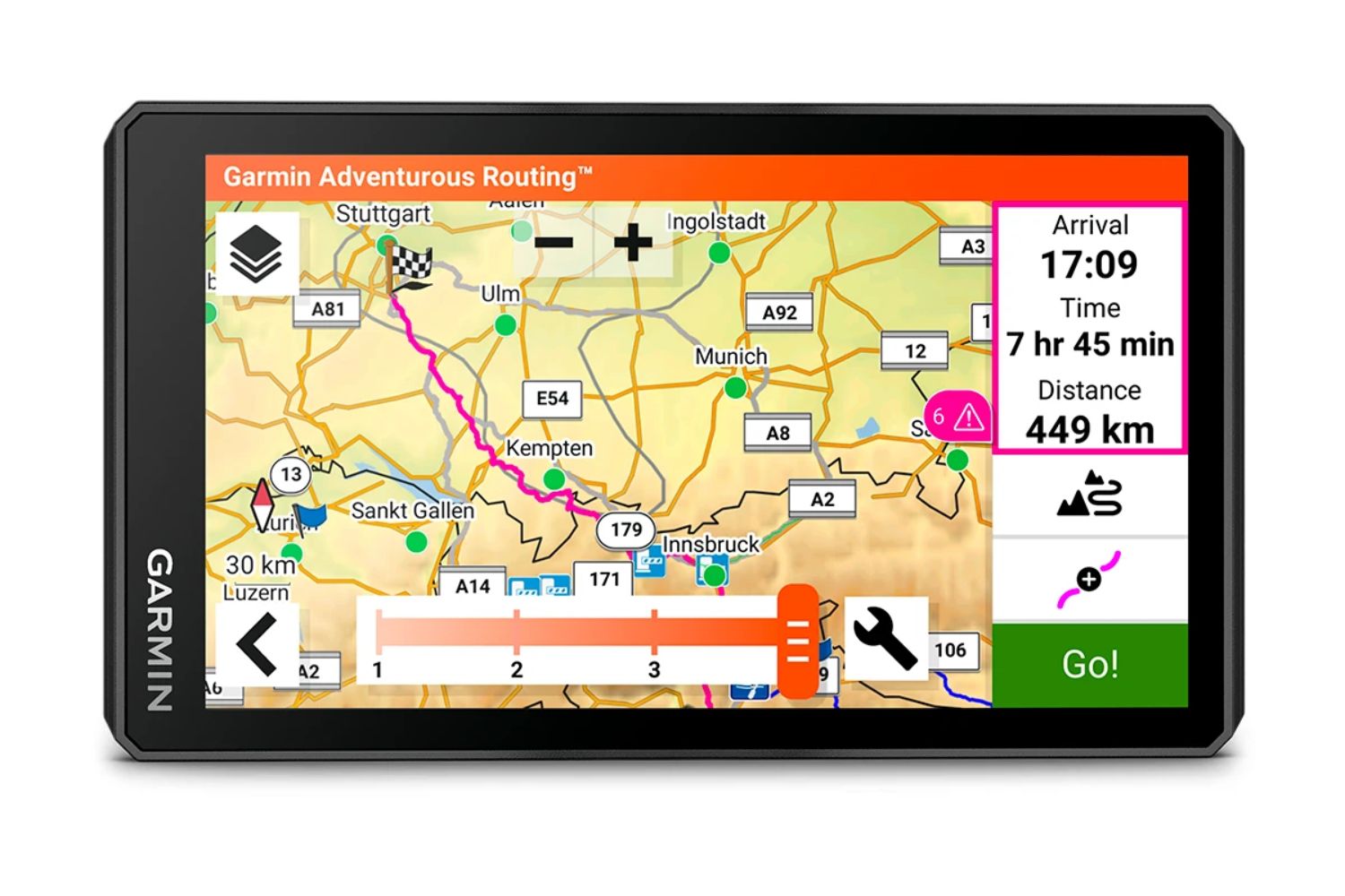
The TomTom Rider 500 is the most popular choice among road bikers. It offers many options for route planning and, having owned one in the past, I remember it being very efficient and reliable. I replaced it for off-road trail management, as it was always trying to get me back on the road…
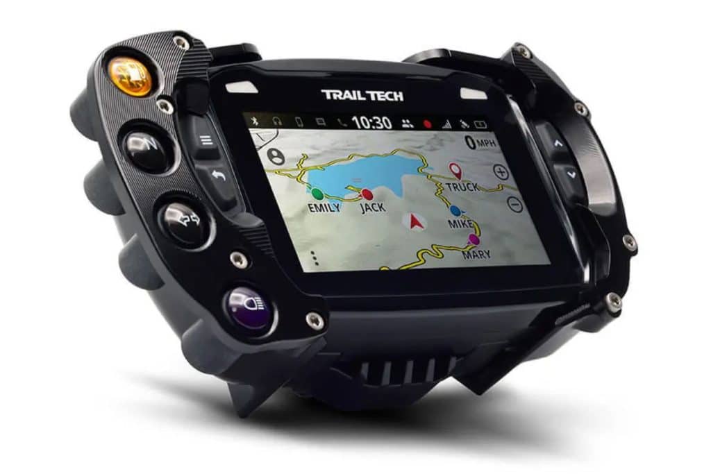
TrailTech also offers a very interesting range of navigation products for off-road motorcyclists, as well as snowmobilers and quad riders. The company offers options ranging from basic GPS to the most comprehensive models. The special feature here is that TrailTech products offer telemetry options. The unit communicates with the vehicle to provide the rider with information such as engine temperature, engine speed and so on. Vehicle-specific mounting options are also available.
All these options meet a wide range of needs that motorcyclists or any other powersports enthusiast are looking for. What’s more, and this is what I like about GPS units, is that they are designed to be used in tough conditions. In fact, mud, water, heat and cold are generally no problem for GPS units.
The “Swiss Army knife” option
An iPhone, Google or Samsung cell phone, to name but a few popular brands, can act as a GPS once a navigation application has been installed. So your phone, which probably contains your favorite music playlist and is already connected to the intercom in your headset, becomes a real Swiss Army knife! But, like a real Swiss Army Knife. However, if you need a pair of pliers, the Swiss Army Knife isn’t as good as a real pair of pliers. On the other hand, the Swiss Army Knife meets the needs of a good number of users.
What’s more, telephones, like the models of the brands mentioned above, are not necessarily designed for use in extreme conditions. Unless, of course, they are protected in shock- and water-resistant cases. Even if the phone is secured in a “heavy duty” case with vibration, many users have had problems with the camera.
That said, in over 10 years of riding with my camera in a handlebar-mounted holder, I’ve never had a problem. But I know people who have.
Also, when the phone goes off-grid, if the maps aren’t downloaded, it becomes useless, as your position is located in nothingness.
This is where using or buying a GPS makes sense.
The Swiss Army Knife 2.0
However, GPS quality and reliability come at a price. And that price was justifiable. Yes, it WAS justifiable. Because for several years now, companies have been offering professional-grade phones and tablets, in some cases even military grade. These devices are not only designed for extreme use, but are also dedicated to GPS use in motorsports. That’s when the purchase of a GPS that serves no other purpose than GPS is questionable.
Mind you, I’m not saying that GPS no longer has a purpose, but I’m simply pointing out that a GPS is a GPS with its limitations.
A phone or tablet, designed for use in conditions encountered in motorsports, offers much more than a GPS, in my opinion.
Scenario 1
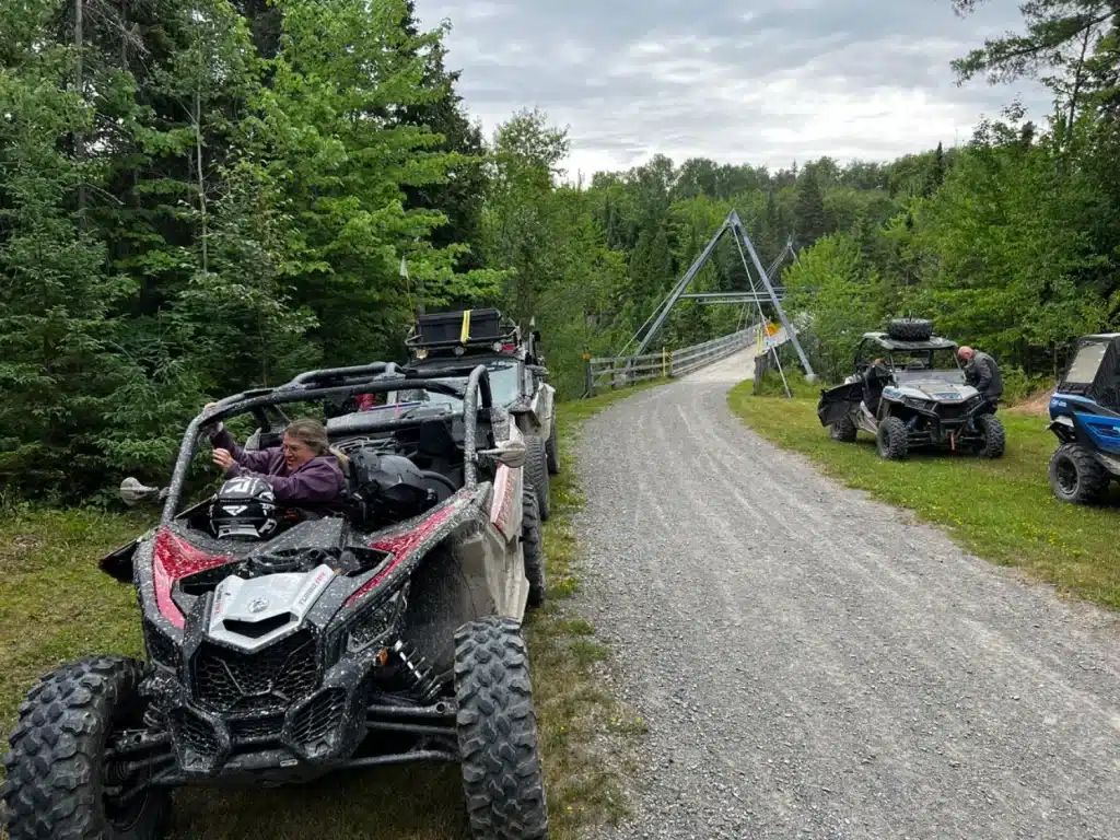
Anyone going on an adventure away from the big cities will have a GPS, their phone and probably also a satellite beacon like Garmin Inreach or Spot.
Once off the cellular network, the GPS will guide you and the beacon will ensure communication with your loved ones. At that point, if the GPX file in your GPS is more than 5 years old and the route it’s taking you on is blocked, what are your options? Because the GPX file, found on a forum, could be a few years old. Or what if the GPX file you’re trying to open on your GPS is too big? Because GPS often requires the use of software on a computer, such as BaseCamp, to manage GPX files.
In fact, I once received a call from a good friend at 11 p.m., who, while traveling in his tent in the Gaspé, asked me to edit a file with software on my PC so that he could continue his trip. Something that wouldn’t have happened if the navigation had been done directly with an application on a tablet or phone.
This friend of mine mentioned to me that he’ll probably be looking at a tablet when the time comes to renew his navigation equipment…
Also, if your phone gives out on you during your trip, you’ll only be able to use your beacon to communicate.
Scenario 2
Let’s take a look at the second option. You leave with your phone, a tablet like Carp Iter, DMD, Oukitel or other, and a beacon. Let’s imagine here that only the phone has a network plan.
As the tablet has more RAM than a GPS and more powerful processors, GPX file management won’t be a problem. In the event of phone failure, the tablet can take over once the SIM card has been transferred. The tablet can also be used as a photo or video camera. It will also be able to update your GPX files or any other track, when you stop at a restaurant and WIFI is available. Since we also live in a world of communications, the tablet can also serve you at all times, just as any other tablet will.
Many applications, one device
With applications such as DMD2 or the Trans-Québec-Trail app, all track updates will be made when the application is opened while the device is on a WIFI or cellular network.
Just in terms of device flexibility, GPS versus tablet or phone, the latter give you a lot more for your money.
Jean-Claude Migneault, motorcycle adventurer, president of the Moto Aventure Bois Franc (MABF) club and owner of Techni-Aventure, who in his professional life is a surveyor and works with the Ministère des Transports du Québec among others, only uses tablets for route management.
He also introduced me to Oukitel products, which are used on construction sites. These are robust, inexpensive products. So much so, in fact, that Jean-Claude bought two of these: one in service and the other in back-up in case something happened to the first. All this for less than the purchase price of a Garmin Zumo XT2.
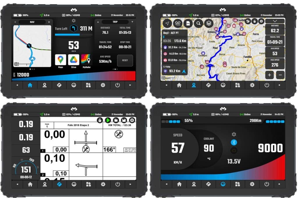
“Versatility of a tablet, customizable interface, Bluetooth telemetry, roadbook in addition to all the apps available on Android.”
Having ridden with him a few times, I can tell you that he doesn’t spare his navigation tools, and he’s never had a problem.
Major projects such as the Trans-Euro-Trail and Trans-Québec-Trail rely heavily on applications that can be used on tablets or phones, not least for security reasons. When you propose a route, it has to be safe and practicable. A tablet, unlike a GPS and its GPX file locked in time, makes updating and managing routes much easier and more flexible.
Even more technology
With advances in satellite communications for conventional phones, and developments in networks such as StarLink, there are fewer and fewer limits to access to the virtual world.
I understand the point of wanting to “ disconnect ” from the frenetic pace of modern life when you’re driving for hours in the forest to camp under the stars, on the shores of a lake, in the middle of nowhere. However, one thing is certain: when it comes to safety and knowing where you are and where you’re going, the reliability of navigation tools is undeniable.
I don’t want you to think that I’m denigrating the GPS. And that goes for all makes and models. Nevertheless, I think the question is increasingly pertinent. GPS or tablet/phone?
I’d love to give you a clear-cut answer, but I’m going to have to tell you to assess your needs, the use you’ll be making of your navigation tool and, of course, your budget.
There’s no such thing as the perfect navigation tool. However, the options to meet all your needs are varied, powerful and increasingly flexible, especially if you opt for a tablet or phone. You should also know that I’ve encountered operating bugs with GPS units as well as Android and Apple tablets.
Finally, if picking up the phone is really your only goal when traveling, the compass will always remain reliable and safe from any programming faults in applications and GPS…